The Chipley, Wausau and Southport Railroad narrow gauge is a fictitious take off on the real standard gauge Birmingham Columbus & St. Andrews Bay Railroad which existed from 1905
when ground was broken until about 1939 when the line was abandoned and scrapped. The BC&StAB never made it to prosperity, but limped along never really reaching further
south than I believe the Tiller community under it's own steam. The Southport Lumber Company laid track and contracted trackage rights to the BC&StAB getting the line south
to the community of Soutport (then Andrews), providing mutual benefits for both parties. The The BC&StAB failed and went into receivership sometime around 19xx, and was later
sold and renamed the Alabama and Western Florida RR which name remained until the end of it's life. The CW&S RR follows the same route with primarily the same cast of characters,
but a slightly different story line. Prosperity did come to the CW&S RR and times are fairly good in the late 1930s.
|
Construction began in 1905 by the Chipley, Wausau and Southport Railroad building a narrow gauge line from a connection with the standard gauge Louisville and Nashville
at Chipley, Florida south to Southport, Florida on the north reaches of St. Andrews Bay. Leaving Chipley, the CW&S RR travels through the scenic communities of Wausau,
Tiller, Greenhead, Merial Lake, Vicksburg and terminating in Southport. The line was finally completed in the summer 1911.
|
CW&S operates two scheduled passenger trains each day, each way between Chipley and Southport, one early morning and one late afternoon. Trains depart Chipley and
Southport at 6:00am and 6:00pm with a scheduled meet at Tiller. There are several flag stop communities along the way which the railroad services.
| <
Scheduled freight service is during the day with a northbound train on Monday, Wednesday and Friday departing Southport at 8:00am. The southbound freight is on Tuesday,
Thursday and Saturday departing Chipley at 8:00am. General freight extras will be run during peak seasons and as circumstnaces dictate. Commodities include agricultural
and livestock, lumber, naval stores (turpentine and pine tars) and finished goods.
|
Logging is also a major contributor to the railroad economy, moving thousands of board feet of lumber into the mill from the outer reaches of the timber operation each
day. Logging extras are run regularly. Special rates are afforded the lumbering operation due to the gross tonnage hauled each month. The agreement benefits the mill by
keeping their slower moving logging locomotives in the woods where they do the heavy lifting, and keeping the railroad open by moving the bulk material with the faster,
heavier road engines.
|
The CW&S owns several 4-6-0 locomotives used for it's passenger operations, a 2-8-0 and a 2-8-2 used for the heavier freight. The CW&S also maintains the logging
locomotives (a Shay, Heisler and Climax) of the Sale-Davis Lumber Company operations, so their presence in the shops in not uncommon.
|
Several coaches, a combine, a baggage and observation car are a part of the passenger roster. Freight cars include a variety of flat, gondola, box, stock and refrigerator
cars. The CW&S RR owns a small ice plant in Southport which it uses to ice down the refrigerator cars as well as selling to the local fishermen and residents. Icing on
the Chipley end is contracted through the L&N facility there.
|
Future plans for the railroad include a crossing of St. Andrews Bay to Lynn Haven making a connection there with the Atlanta and St. Andrews Bay Railway, whose line
continues to it's terminus in St. Andrews by way of Panama City.
|

|
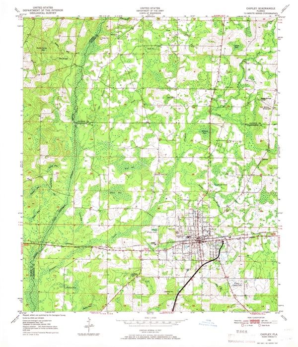
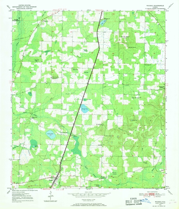
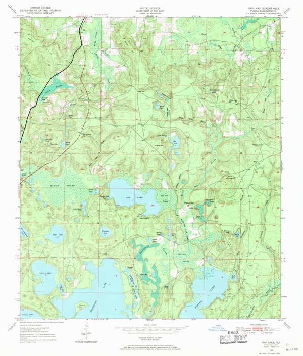
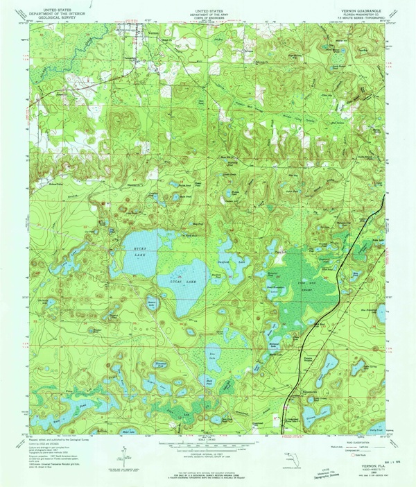
Along the Line - Maps
|

|
|
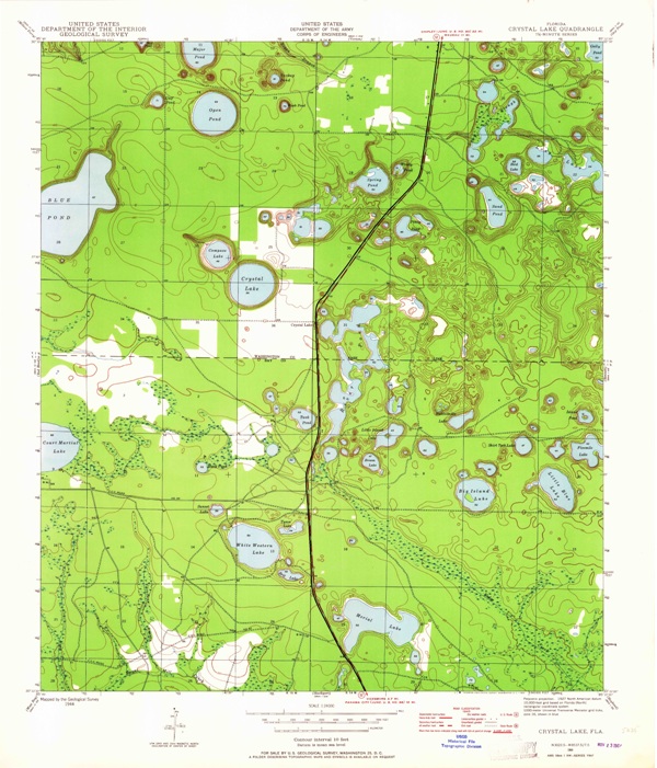
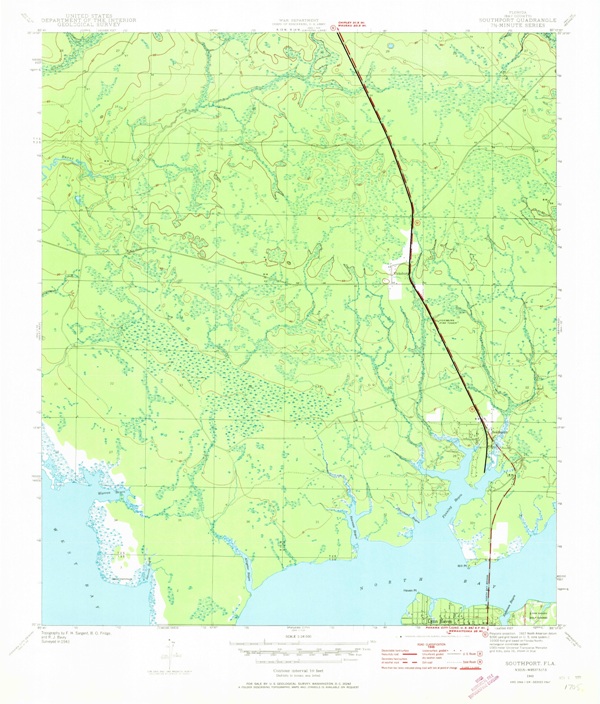
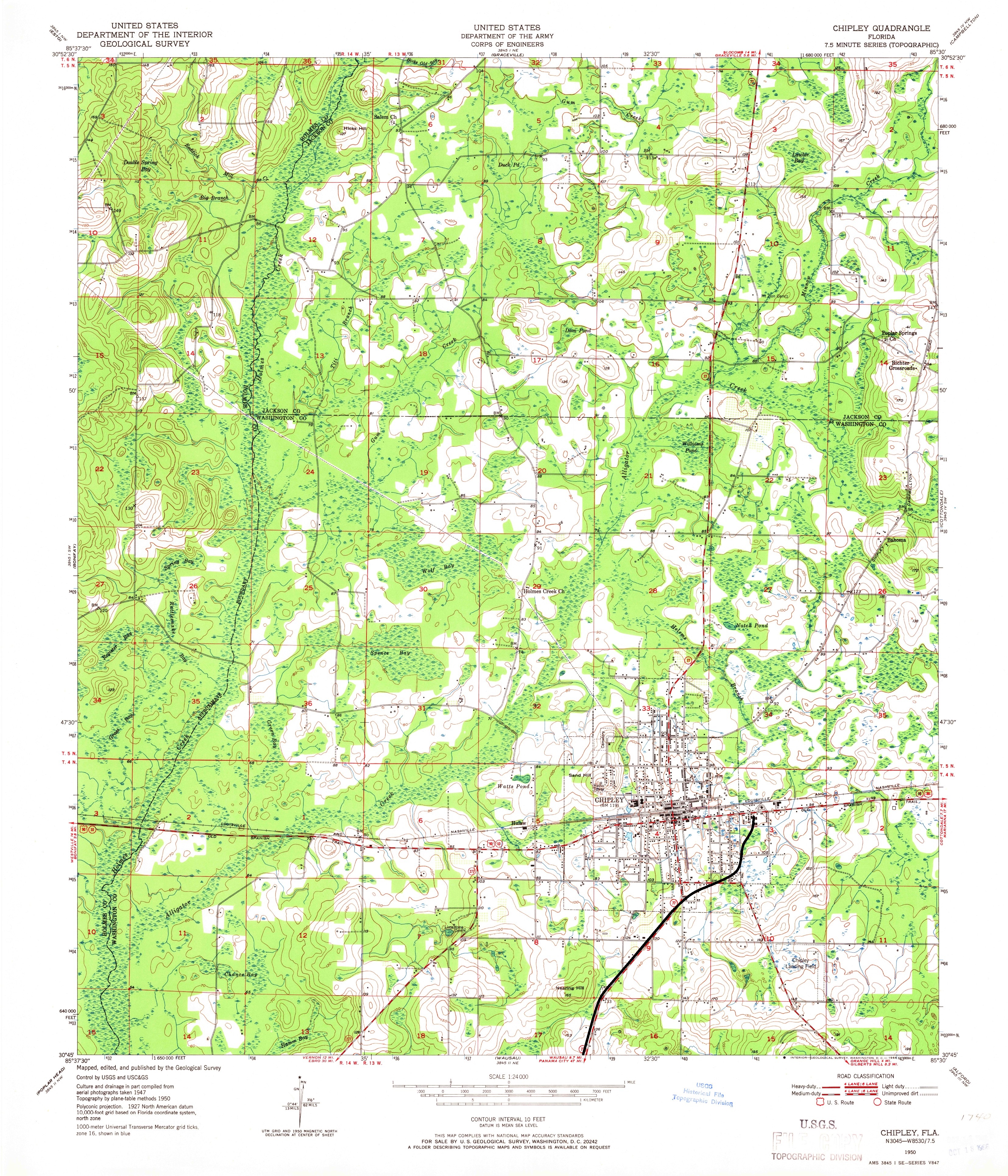
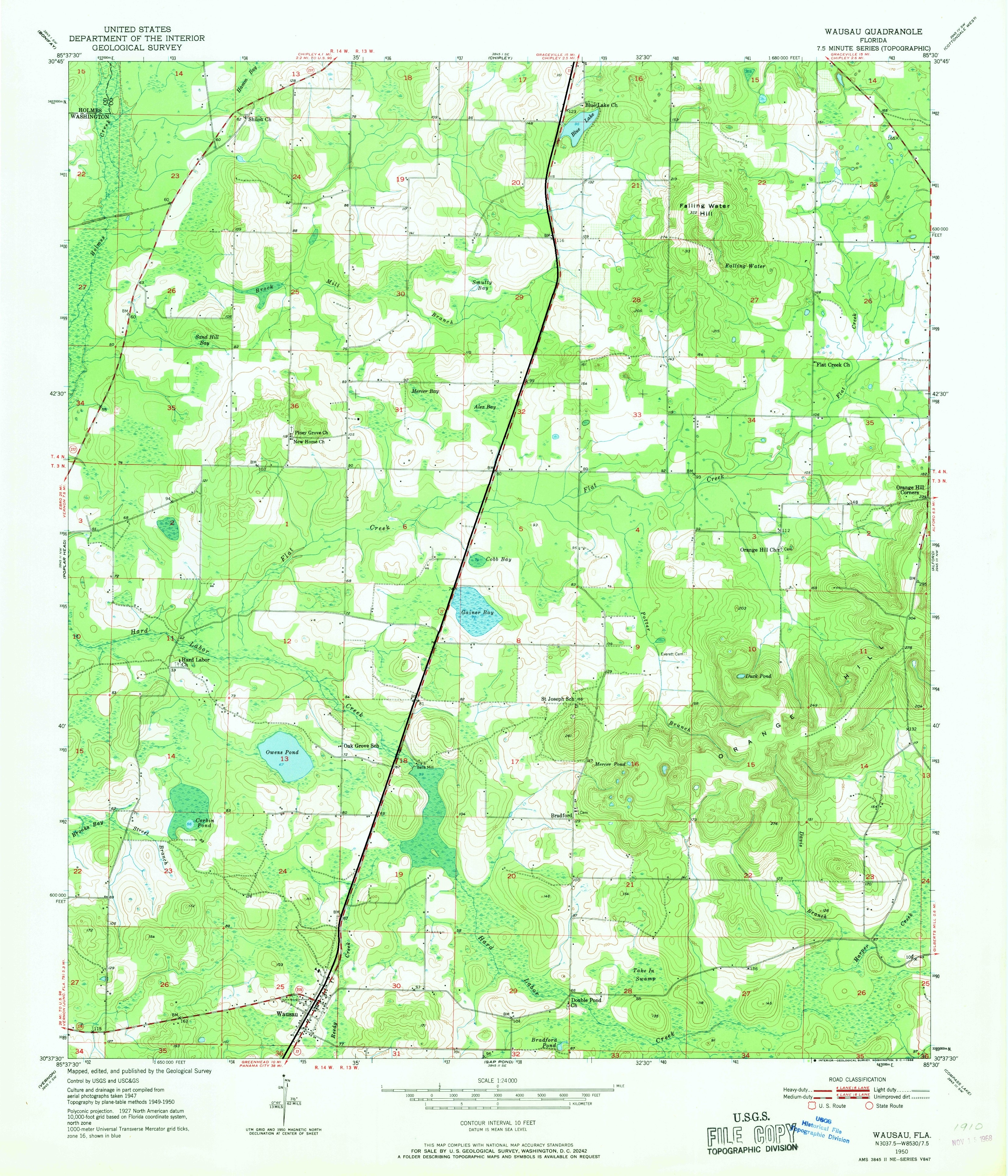
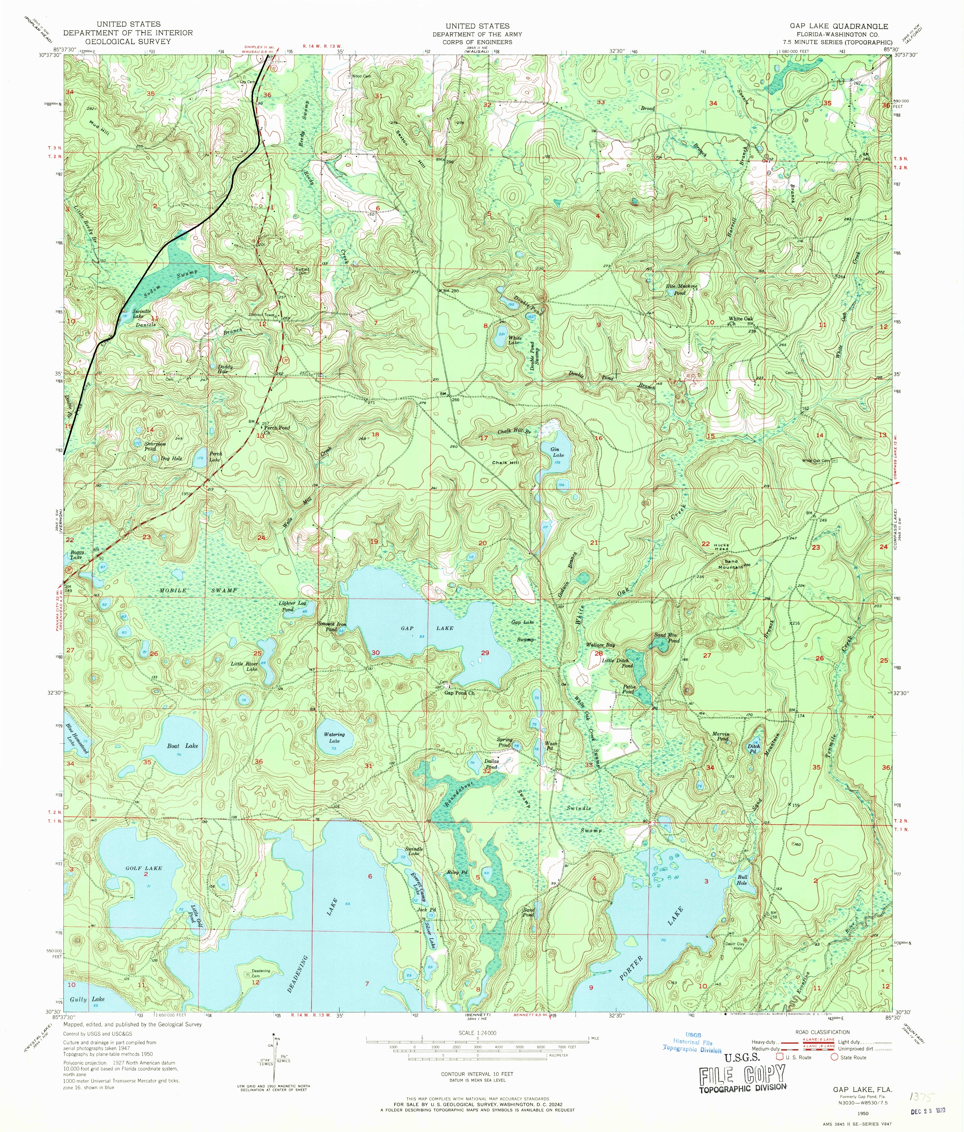
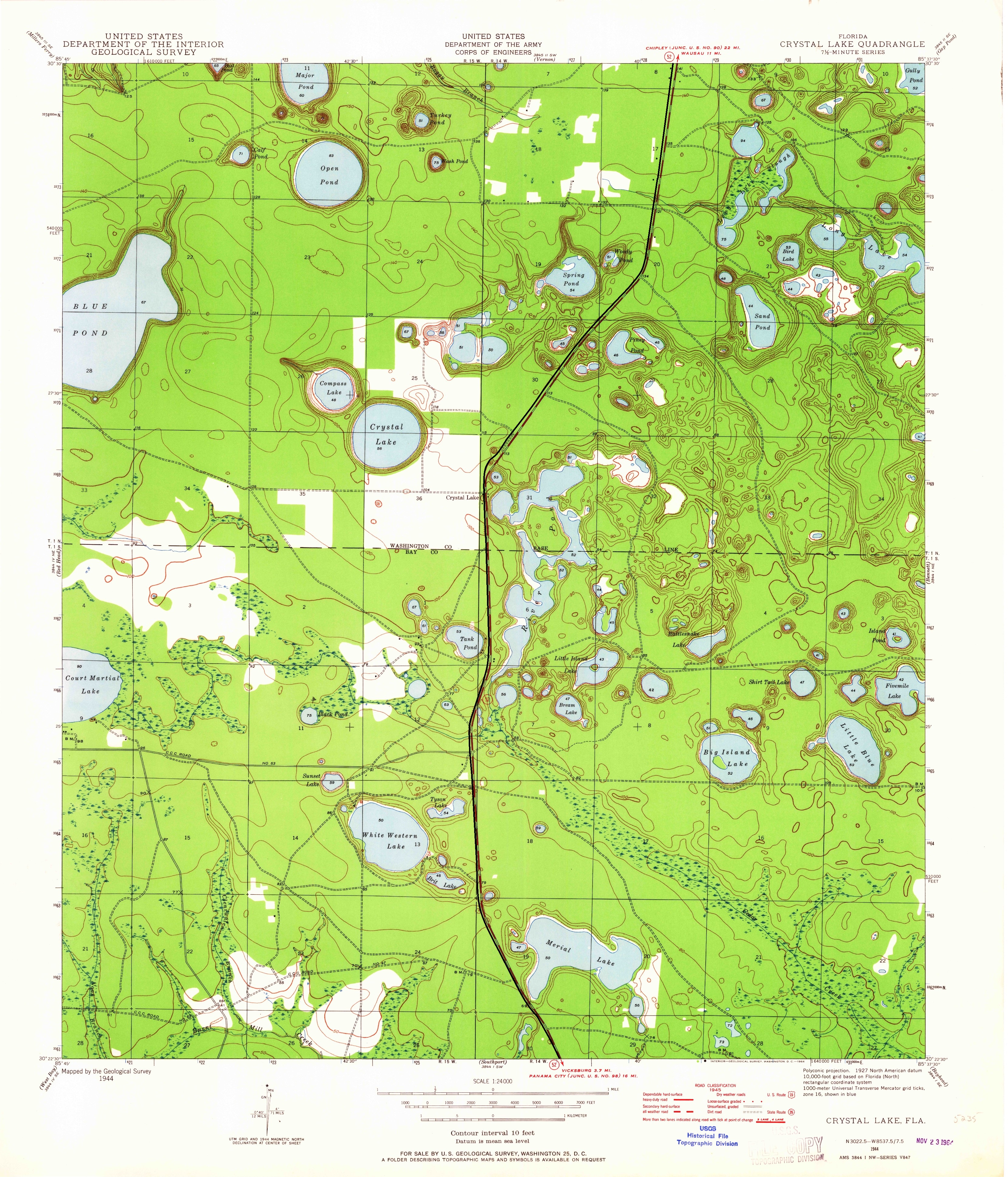
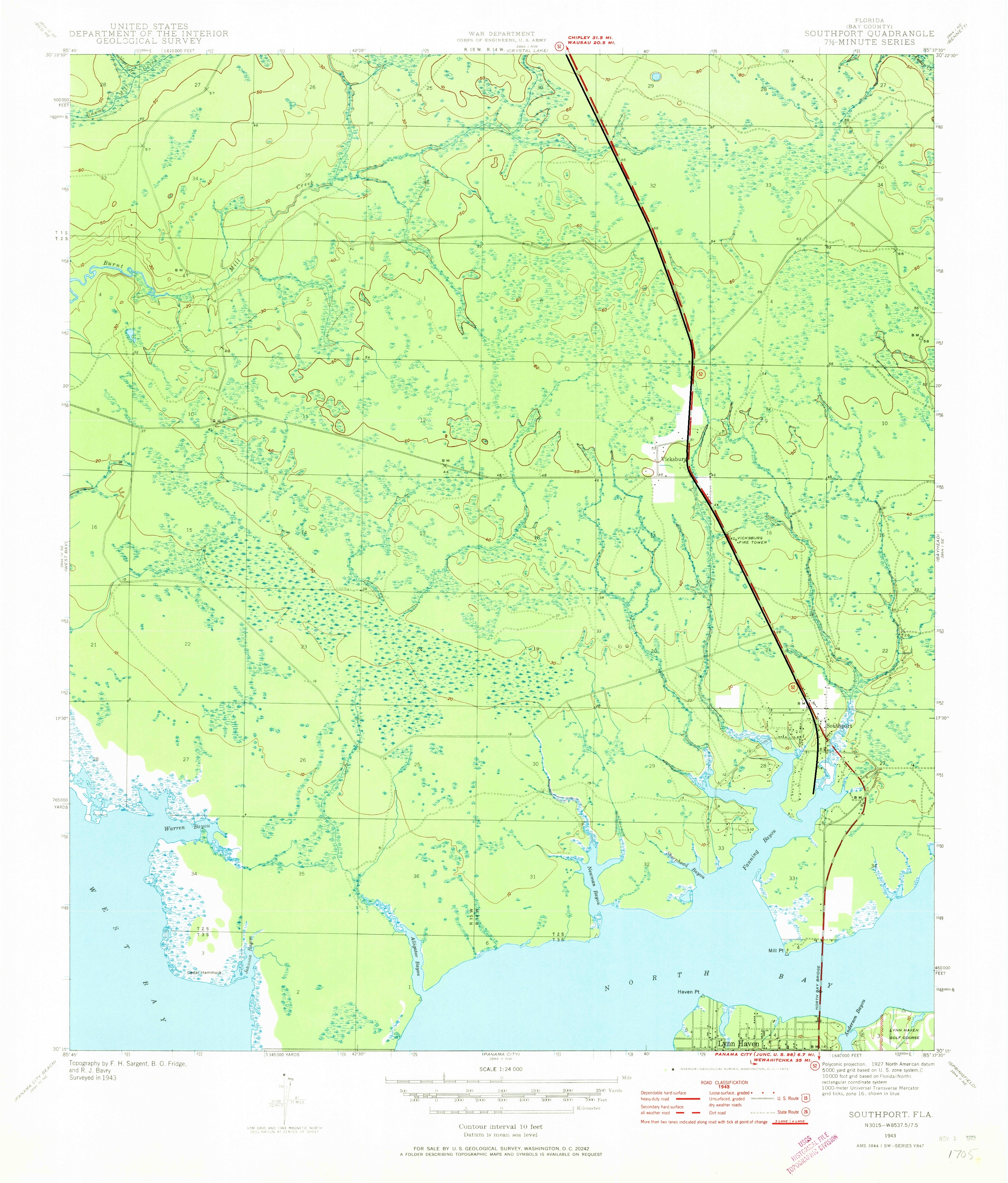
All the maps provided below are freely available from the USGS web site
USGS Historical Maps .
In my reserach of the prototype I located these maps dating from the 1950's, most
are 10-15 years after the prototype line was torn up and scrapped. I believe that I have been able to farily accurately locate most of the original
right-of-way using what historical data and remaining land formations (fills, cute, etc.) I have at my disposal. The original PDFs were converted
to JPGs to allow me to add the right-of-way for graphical reference.
|
|
|
Chipley Quadrangle
|
|
|
Wausau Quadrangle
|
|
|
Gap Pond Quadrangle
|
|
|
Vernon Quadrangle
|
|
|
Crystal Lake Quadrangle
|
|
|
Southport Quadrangle
|